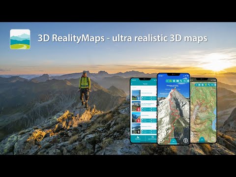
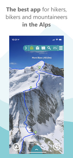
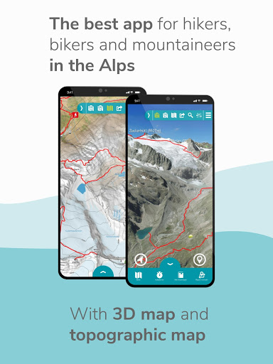
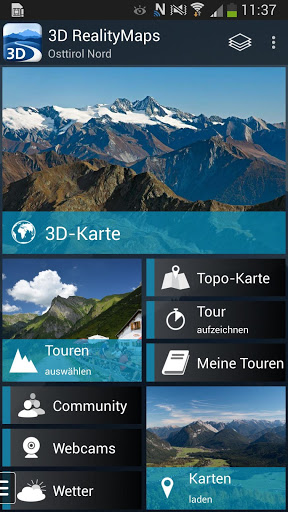
OUTDOOR APP FOR PERFECT PLANNING AND ORIENTATION ON THE WAY
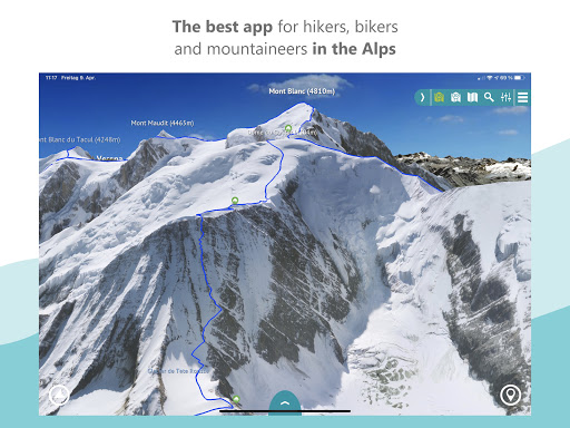
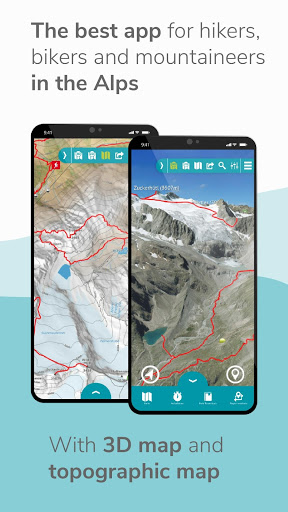
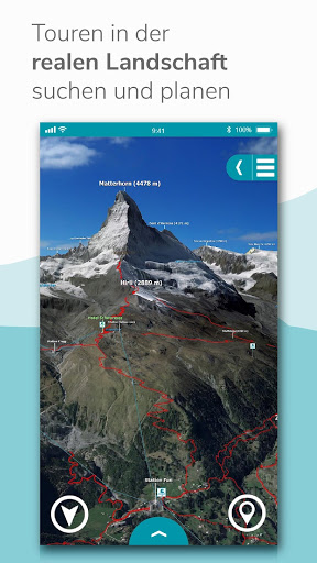
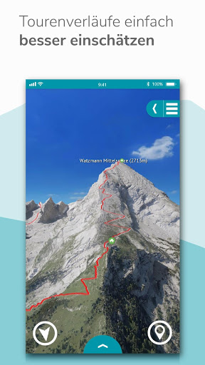
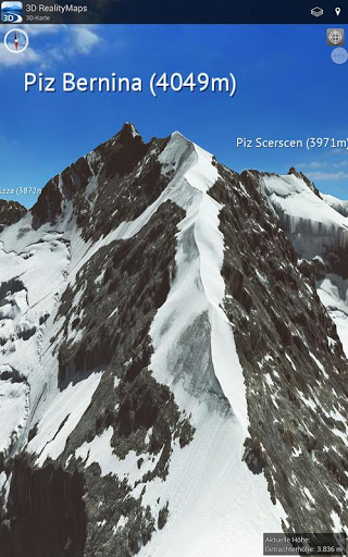
The award-winning app is the perfect tool for planning your outdoor activities. The unique, ultra-realistic 3D representation of the mountains allows you to better assess the terrain and inspires new adventures. The app offers many practical features such as GPS tracking, a route planner, a GPX import function and map download for offline use.
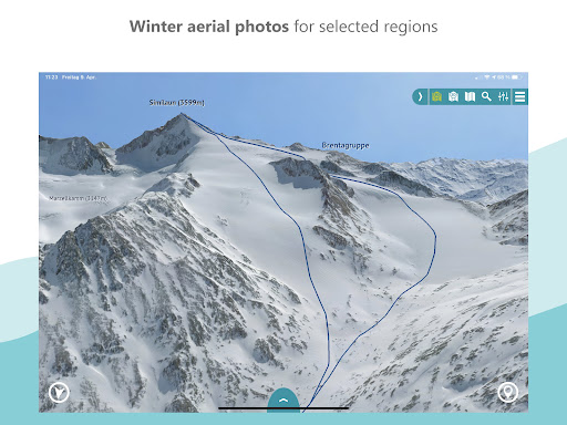
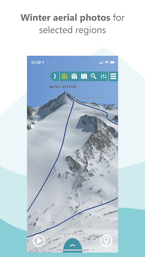
MAPS FOR SUMMER & WINTER
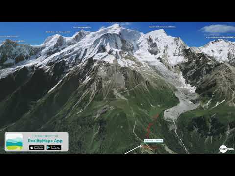
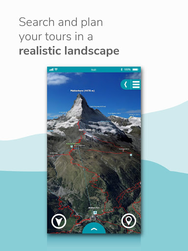
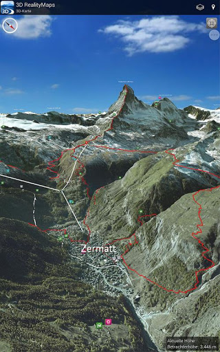
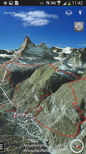
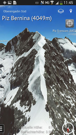
Our ultra-realistic 3D maps are the most accurate maps on the market. We calculate the 3D maps with innovative technology from aerial and satellite images. Currently there are the following regions
- Alps
- Pyrenees
- Balearic Islands
- Canary Islands
- Corsica
- Mt Everest & Himalaya
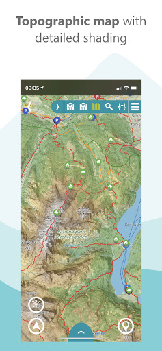
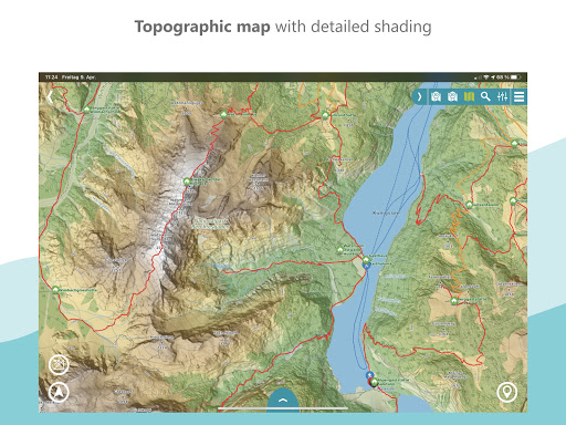
The app also offers a worldwide topographical map with unique 3D relief shading at a scale of 1:10,000 free of charge.
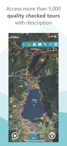
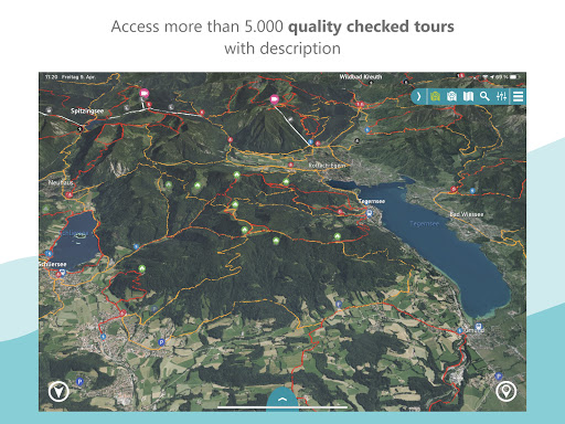
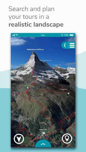
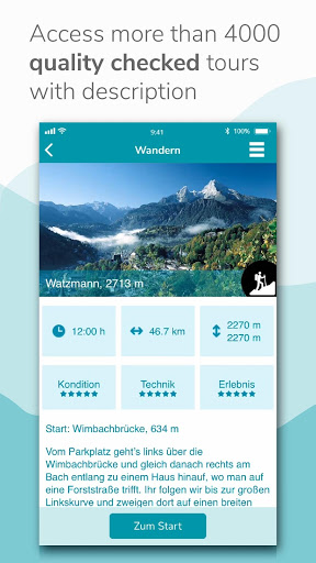
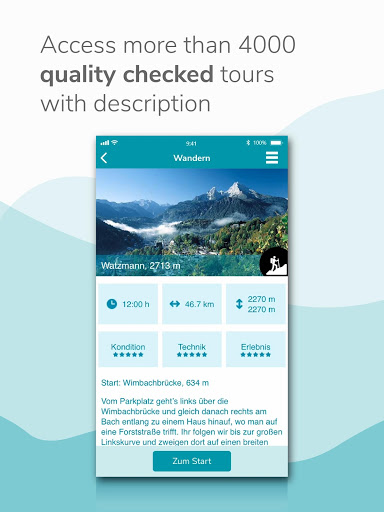
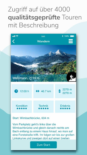
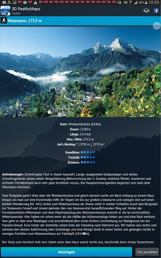
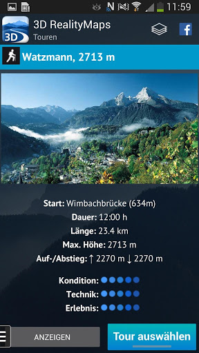
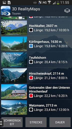
QUALITY-CERTED TOURS
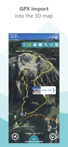
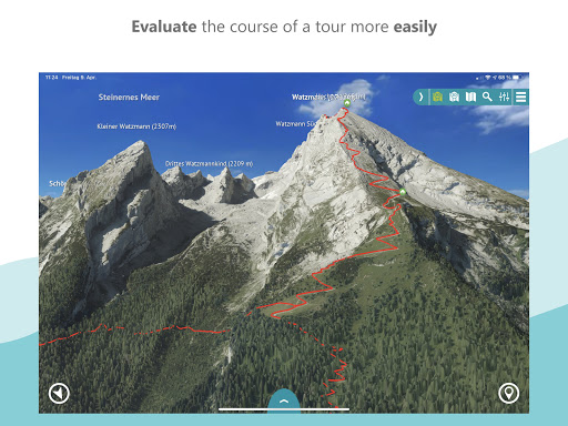
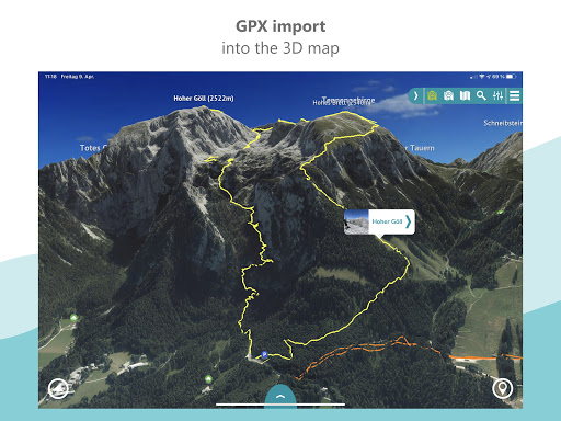
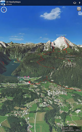
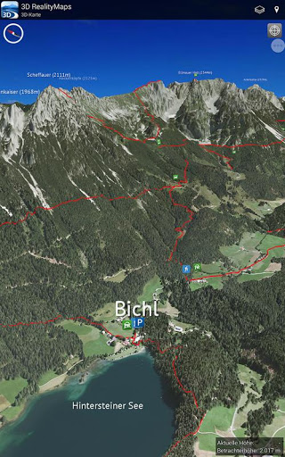
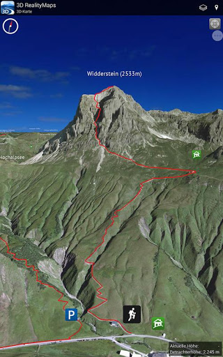
The app offers hiking, mountain, ski and bike tours exclusively researched by experts from Bergverlag Rother and other partners. Using the built-in GPS you can easily follow the marked route while on tour. A highlight is the import of any tours in GPX format or from Komoot into the 3D map
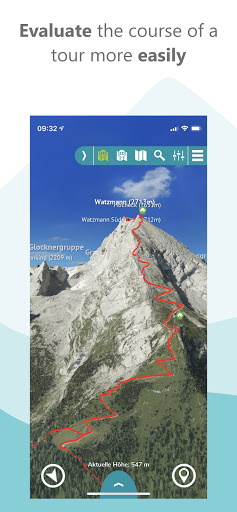
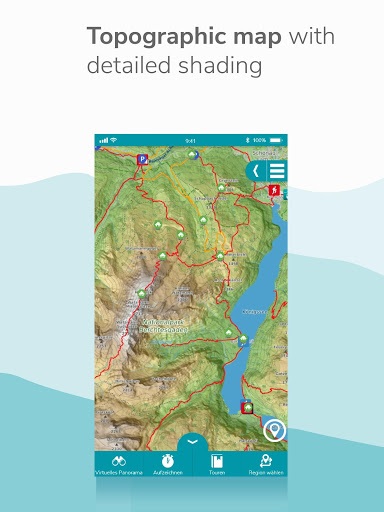
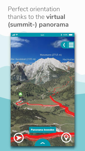
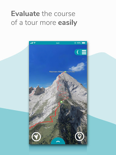
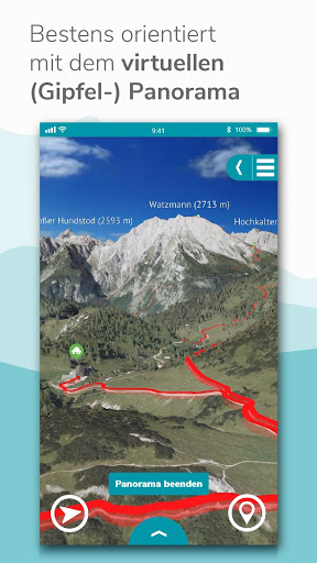
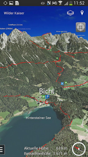
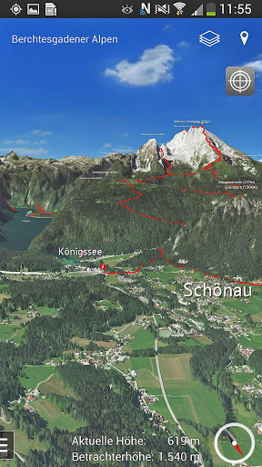
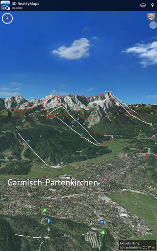
SIMPLE AND SAFE ORIENTATION ON THE MOVE
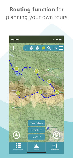
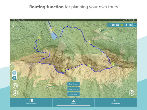
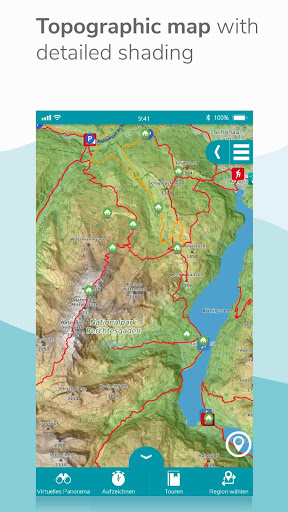
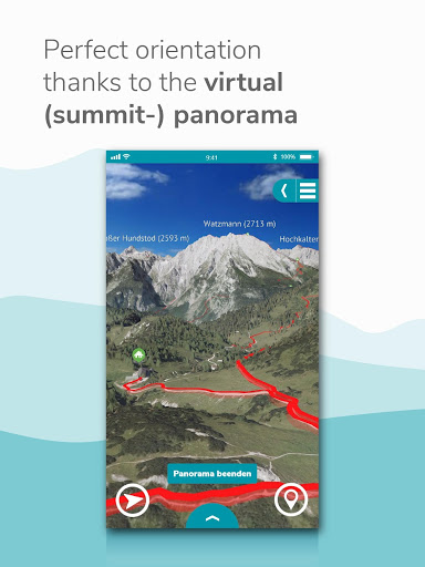
With the combination of 3D map, aerial photo and topographical relief map on a scale of 1:25,000, you can perfectly prepare yourself for a trip. With the routing function, you can plan new routes on the 3D map. The GPS tracking function turns your smartphone into a full-fledged navigation device. On tour, your current location is always displayed live on the map. A virtual 360° panorama with information about the surrounding landscape makes it easier for you to find your way around.
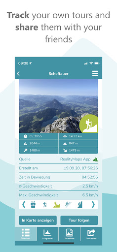
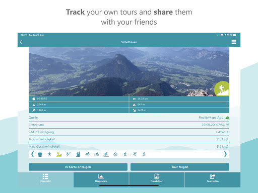
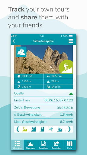
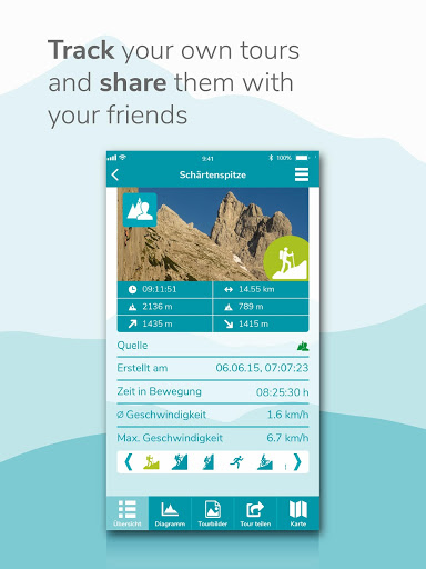
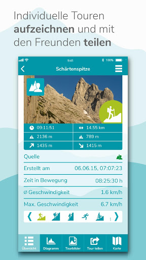
RECORD YOUR OWN TRACKS
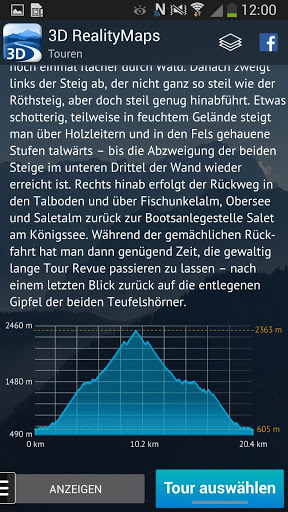
With the tracking function, you can record your track and display the route covered live on the 3D map. Duration, distance, altitude and speed are continuously determined. With a user account, you can save the recorded tracks in your personal tour cloud, transfer your tracks to other smartphones or tablets and share them with friends.
MORE SAFETY IN THE MOUNTAINS - OFFLINE MAPS
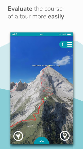
The app offers an unprecedented level of security. In the photo-realistic 3D map you can read the exposure and condition of the terrain and identify danger spots. In bad weather, in fog or at night, you can find your way around as the map depicts the real terrain. Another safety aspect: you can load the maps onto your smartphone for offline use.
EXCLUSIVELY FOR PREMIUM USERS
With a PREMIUM subscription, you can record, save, share and transfer your tracks to other devices, save maps offline on your smartphone, import tours in GPX format and from Komoot, and plan tours in 3D. With the subscription we finance the further development of the app and the creation of the 3D maps. The subscription runs through the store and can be canceled at any time
FREE TRIAL SUBSCRIPTION
With a test subscription you can use all PREMIUM functions for one week free of charge.
For more information visit https://www.realitymaps.app/realitymaps-app/
Terms and Conditions: https://www.realitymaps.app/agb/
- Planning routes is now even easier
- Over 10,000 new tours
- Faster app launch
- Full integration of the new Tour Planner for the PC
- Plan with the Tour Planner for the PC directly on the 3D map
- Planning routes is now even easier
- Over 10,000 new tours
- Faster app launch
- Full integration of the new Tour Planner for the PC
- Plan with the Tour Planner for the PC directly on the 3D map
- Planning routes is now even easier
- Over 10,000 new tours
- Faster app launch
- Full integration of the new Tour Planner for the PC
- Plan with the Tour Planner for the PC directly on the 3D map
- Planning routes is now even easier
- Over 10,000 new tours
- Faster app launch
- Full integration of the new Tour Planner for the PC
- Plan with the Tour Planner for the PC directly on the 3D map
- Planning routes is now even easier
- Over 10,000 new tours
- Faster app launch
- Full integration of the new Tour Planner for the PC
- Plan with the Tour Planner for the PC directly on the 3D map
Several improvements and bug fixes.
Improved loading time of the app
Further improvements and bug fixes
Improved loading time of the app
Further improvements and bug fixes
Discover the new regions "Julian Alps" and "Savinja Alps" as well as the new 3D winter map of the Pyrenees!
Discover the new regions "Julian Alps" and "Savinja Alps" as well as the new 3D winter map of the Pyrenees!
Brand new 3D maps!
Discover the following new regions in addition to the existing 3D maps of the Alps:
- Himalaya with the highlight Mount Everest and Khumbu
- Ladakh
- Balearic Islands
- Canary Islands
- Corsica
- Pyrenees
Brand new 3D maps!
Discover the following new regions in addition to the existing 3D maps of the Alps:
- Himalaya with the highlight Mount Everest and Khumbu
- Ladakh
- Balearic Islands
- Canary Islands
- Corsica
- Pyrenees
Brand new 3D maps!
Discover the following new regions in addition to the existing 3D maps of the Alps:
- Himalaya with the highlight Mount Everest and Khumbu
- Ladakh
- Balearic Islands
- Canary Islands
- Corsica
- Pyrenees
Brand new 3D maps!
You can now discover Mount Everest and the Canaries in 3D, in addition to the existing 3D map of the Alps.
Updated 3D winter map
General improvements
Winter update 2021: more information about ski resorts, improved readability of the winter map and much more!
Winter update 2021: more information about ski resorts, improved readability of the winter map and much more!
Winter update 2021: more information about ski resorts, improved readability of the winter map and much more!
General improvements
Added support for heart rate sensors by Polar: Keep track of your heart rate while recording your trips
Improved compatibility of exported GPX tracks, e.g. for Garmin, Komoot, etc.
Added support for heart rate sensors by Polar: Keep track of your heart rate while recording your trips
Improved compatibility of exported GPX tracks, e.g. for Garmin, Komoot, etc.
Road network visible Alps-wide in the 3D map
General improvements
General improvements
General improvements
General improvements
New high-resolution 3D data in Slovenia and the French Alps
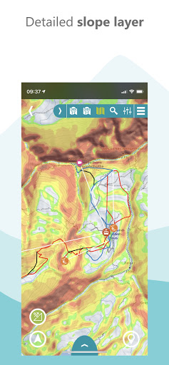
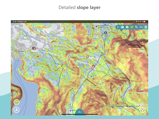
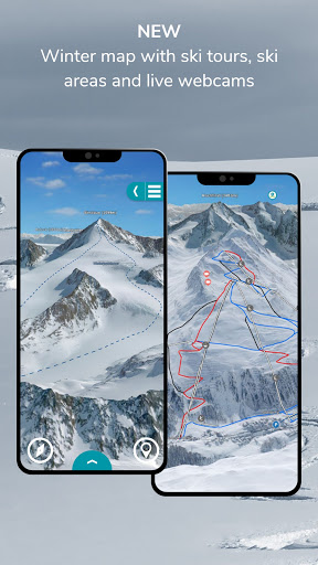
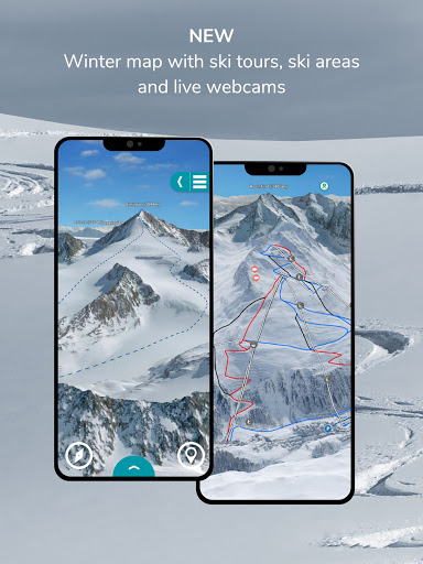
Slope layer for the topo map
Switch summer/winter
Winter relief map
Skitours
All skiing areas
Live webcams with location
Switch summer/winter
Winter relief map
Skitours
All skiing areas
Live webcams with location
Switch summer/winter
Winter relief map
Skitours
All skiing areas
Live webcams with location
Switch summer/winter
Winter relief map
Skitours
All skiing areas
Live webcams with location
General improvements
General improvements
Changed app name
General improvements
Changed app name
General improvements
Improved accuracy of track statistics
General improvements
General improvements and bug fixes
Fixed critical crash in Android 10
General improvements and bug fixes
As the touring season approaches, we have completely revised the app and given it a modern, cooler design with more intuitive handling. Enjoy and have fun in the Alps! Your 3D Outdoor Guides Team
General improvements.
Critical bugfix for some tablets.
Another fix for Komoot tour upload
Fixed crash related to Komoot tours
Fixed community login
Critical bugfix for Android 8
Fixed an ugly bug that prevented the app from starting correctly on Android versions less than 5.0.
fixes bugs and improves layout
General improvements.
Bugfixes regarding the offline coverage download:-When trying to download the offline coverage for "Alps Base Map", the app could freeze.-It could happen that the list entries were not updated and thus the download progress was not visible.
Fundamental rework with a new abo system and focus on user friendliness and intuitive handling.New features like Virtual Panorama, GPX import, and connection to Komoot.Experience the Alps in 3D as never before!
*** new, more detailed topo map in 1: 25,000 scale covering the entire Alps and Germany*** record tours outside the 3D maps*** save geocoded photos with self-recorded tours*** share screenshots from the 3D Map with self-recorded tours*** share self-recorded tours with friends*** complete overhaul of the user interface